1/1 Oops. Incorrect.
0%
0pts Earned
0/1correct
21/21
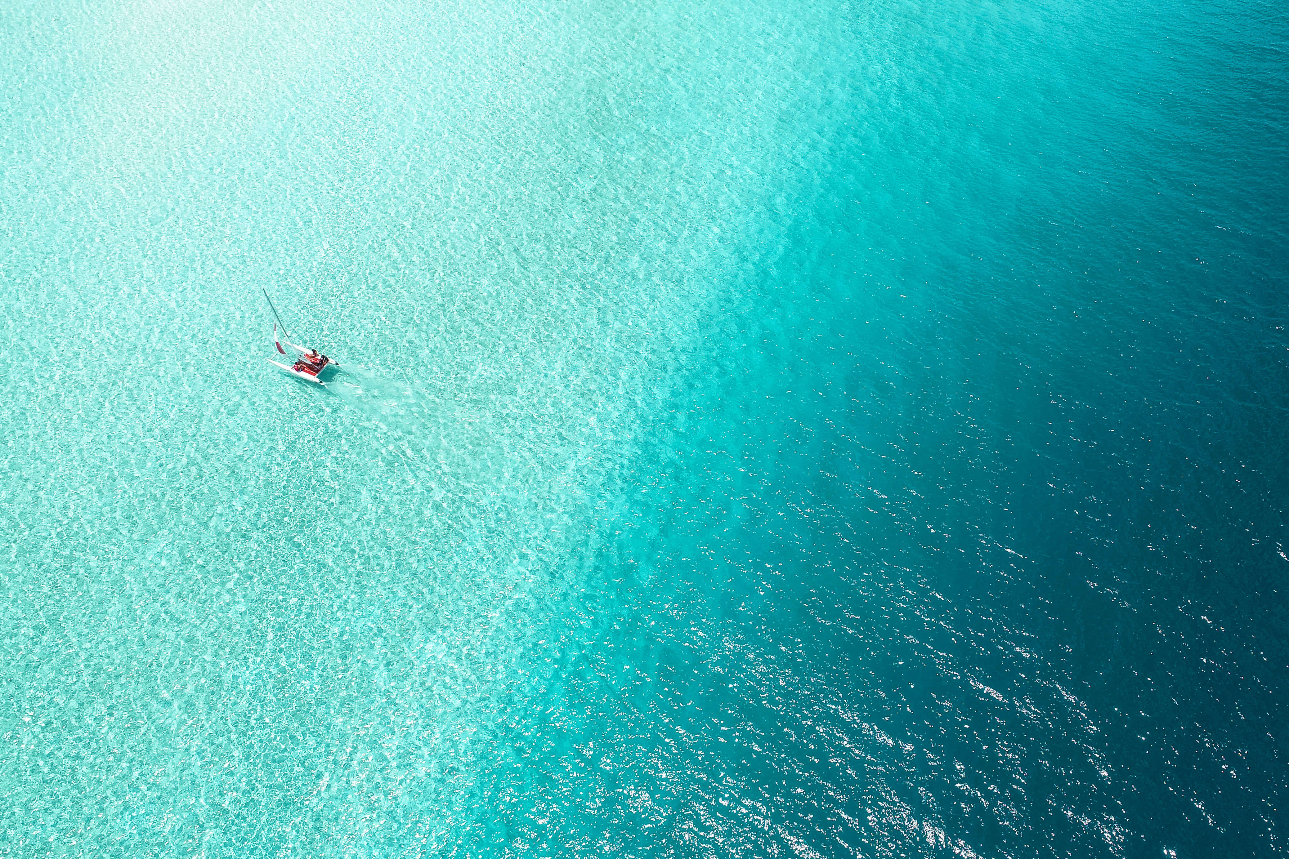
Which of these seas has mostly disappeared since the 1960s?
At one point, the Aral Sea between Kazakhstan and Uzbekistan was the fourth-largest lake in the world, covering more than 26,000 square miles. Today, the sea occupies just 10% of its original surface area and no longer supports fish life, thanks to the Soviet Union's expansion of agricultural production in central Asia during the 1960s. Given the arid climate, farms required a lot of water, so irrigation was used to divert water from the rivers that fed the Aral Sea.
Source: The New York TimesIonian Sea
18%
Barents Sea
19%
Aral Sea
54%
Java Sea
9%
20/21
Which sea is home to the world's deepest underwater sinkhole?
Blue holes are deep underwater caverns or sinkholes in the middle of the ocean that create a distinctive blue circle on the water’s surface. In 2016, researchers discovered the deepest of these sinkholes in the South China Sea. The Dragon Hole (also known as the Yongle Blue Hole) stretches 987 feet below the surface, a measurement taken using an underwater robot with a depth sensor.
Source: CNNEast Siberian Sea
16%
South China Sea
21%
Caribbean Sea
49%
Adriatic Sea
14%
19/21
What is the world's saltiest oceanic sea?
With an average salinity of around 4%, the Red Sea is the saltiest oceanic sea in the world. An arm of the Indian Ocean, the long and narrow Red Sea stretches from Suez, Egypt, to the Bab el-Mandeb Strait, connecting it to the Gulf of Aden and the Arabian Sea. The sea’s high salinity is due to high evaporation and little fresh water inflow.
Source: World AtlasSolomon Sea
15%
Labrador Sea
9%
Kara Sea
8%
Red Sea
68%
18/21
The Weddell, Davis, Ross, and Amundsen Seas all border what continent?
The Southern Ocean, which surrounds Antarctica in the Antarctic Circle, has many marginal seas surrounding the icy continent. Among those are the Weddell Sea, which covers more than a million square miles, and the Amundsen Sea, which is named for the polar explorer Roald Amundsen. These seas are often largely covered in glaciers and sea ice, which makes it difficult to delineate where the water ends and the continent begins.
Source: National Snow & Ice Data CenterAfrica
5%
Antarctica
87%
South America
5%
Asia
2%
17/21
The Laccadive, Timor, and Arabian are all marginal seas of which ocean?
Marginal seas are oceanic areas that are slightly separated from the greater body of water by an island, peninsula, or archipelago. They are generally shallower than the main ocean and have close proximity to land. In the case of the Indian Ocean, these marginal seas include the Andaman Sea near Southeast Asia, the Arabian Sea to the west of India, the Laccadive Sea bordering the Maldives, and the Timor Sea near Australia.
Source: World AtlasAtlantic Ocean
6%
Indian Ocean
82%
Southern Ocean
5%
Pacific Ocean
7%
16/21
What sea is also known as the West Philippine Sea or North Natuna Sea?
While most of the English-speaking world knows the body of water south of China as the South China Sea, some countries call it by a different name. Due to their ongoing dispute with China over the Spratly Islands, the Philippines officially refers to it as the West Philippine Sea. Similarly, to safeguard its economic claims over the southern portion of the sea, Indonesia renamed the body the North Natuna Sea due to its location around the Natuna Islands.
Source: The DiplomatSea of Japan
24%
South China Sea
54%
Bay of Bengal
14%
Yellow Sea
7%
15/21
What sea separates China from the Korean Peninsula?
Known as “Huang Hai” in Chinese and “Hwanghae” Korean, the Yellow Sea is a 435-mile-wide body of water that separates China from the Korean Peninsula, located north of the East China Sea. It's called the Yellow Sea because in places, the sediment-rich rivers that feed it (including the Yangtze) cause the water to turn a murky color that can appear almost yellow.
Source: BritannicaSouth China Sea
56%
Black Sea
1%
Yellow Sea
37%
Sea of Okhotsk
6%
14/21
The Celebes Sea, Banda Sea, and Java Sea all border which country?
The archipelagic nation of Indonesia has many seas that separate its myriad islands, including the Java Sea, Banda Sea, Celebes Sea, Arafura Sea, Molucca Sea, and Flores Sea, among many other straits, gulfs, and passages. Indonesia is made up of more than 17,000 islands, 922 of which are permanently inhabited, making it the largest island country in the world.
Source: BritannicaMadagascar
11%
Indonesia
82%
Italy
2%
India
5%
13/21
The Salish Sea borders part of what U.S. state?
The Salish Sea is the body of water off the northwestern coast of Washington and the southwestern coast of British Columbia that includes Puget Sound, the Strait of Georgia, and the Strait of Juan de Fuca. The sea's name, adopted in 2010, pays homage to the Coast Salish people who lived in the area and acknowledges that all of its constituent bodies of water are also part of a larger integrated ecosystem.
Source: SeaDoc SocietyTexas
8%
Maine
30%
Washington
53%
Michigan
9%
12/21
Which of these islands is NOT in the Caribbean Sea?
The Caribbean Sea is home to hundreds of islands, including Aruba, Jamaica, Hispaniola (shared by Dominican Republic and Haiti), Cuba, Puerto Rico, Martinique, and many more. Bermuda, however, is located to the north in the middle of the Atlantic Ocean, about 800 miles away from the Caribbean. The small British territory is actually an archipelago of seven main islands, which together stretch for roughly 24 miles.
Source: BritannicaAruba
17%
Jamaica
4%
Bermuda
59%
Puerto Rico
20%
11/21
Which Asian sea is often considered the world's largest lake?
While the definitions for different bodies of water are not always clear, most geographers agree that the Caspian Sea is technically a lake because it doesn't directly connect to any oceans. That would make the Caspian the largest lake in the world by a long shot — it has a surface area more than four times the size of Lake Superior, which comes in second place.
Source: BritannicaLaccadive Sea
10%
Arabian Sea
8%
Dead Sea
25%
Caspian Sea
56%
10/21
What is the world's only sea with no land border?
The Sargasso Sea is the only sea in the world without a land boundary. Instead, its borders are defined only by ocean currents. The Sargasso Sea lies within the Northern Atlantic Subtropical Gyre and is bounded to the west by the Gulf Stream, to the north by the North Atlantic Current, to the east by the Canary Current, and to the south by the North Atlantic Equatorial Current. Due to this unique structure, the Sargasso Sea constantly fluctuates in size and shape.
Source: NOAASargasso Sea
72%
Sea of Okhotsk
12%
Barents Sea
9%
Andaman Sea
7%
9/21
Which of these countries does NOT border the Baltic Sea?
The Baltic Sea covers about 149,000 square miles of European water area, bordering Sweden, Denmark, Finland, Estonia, Latvia, Lithuania, Russia, Poland, and Germany. The largest expanse of brackish water in the world, the Baltic has smaller subsections including the gulfs of Bothnia, Finland, and Riga, all of which combine to form one of northern Europe's most important bodies of water.
Source: BritannicaEstonia
12%
Poland
22%
Finland
11%
The Netherlands
55%
8/21
Which two countries are separated by the Tasman Sea?
The Tasman Sea, named for Dutch explorer Abel Tasman, is the body of water between the Southern Hemisphere countries of Australia and New Zealand. It also lies on the eastern edge of the Australian island of Tasmania, which shares its root word. The Tasman Sea is part of the southwestern Pacific Ocean and also merges with the Coral Sea to the north and the Indian Ocean to the southwest.
Source: BritannicaAustralia and New Zealand
86%
South Korea and Japan
3%
Mozambique and Madagascar
9%
United Kingdom and Iceland
1%
7/21
What mountain range extends from the Black Sea to the Caspian Sea?
The Caucasus Mountains extend from the Black Sea approximately 750 miles southeastward to the Caspian Sea. The mountains are also a watershed point to create a rough geographical border dividing Europe and Asia. The range's highest peak is Mount Elbrus — at 18,510 feet, it is the highest peak in both Russia and Europe.
Source: BritannicaPyrenees Mountains
19%
The Dolomites
11%
Ural Mountains
35%
Caucasus Mountains
35%
6/21
The Danube, Dnieper, and Dniester rivers all flow into which sea?
The Black Sea lies between Europe and Asia, south of Ukraine, north of Turkey, and west of the Caucasus Mountains. Six countries have borders along the large body of water, while its drainage basin includes parts of 24 European nations. The Black Sea is supplied by many of the continent's major rivers, including the Danube, Dnieper, Dniester, and Don.
Source: World Wide Fund for NatureRed Sea
16%
Ross Sea
5%
Arabian Sea
10%
Black Sea
69%
5/21
Which of these colorfully named seas is the farthest north?
The Red Sea is located between Africa and the Middle East, the Yellow Sea sits east of China, and the Black Sea is north of Turkey. Finally, with a latitude around 65 degrees north, the White Sea is the northernmost of the colorfully named seas. Located in the northwest corner of Russia, the White Sea is a southern inlet of the larger Barents Sea, separated by the Kola Peninsula.
Source: Something GeographyWhite Sea
42%
Red Sea
9%
Black Sea
38%
Yellow Sea
11%
4/21
The Ionian, Tyrrhenian, and Ligurian Seas are all sections of what sea?
The Mediterranean Sea covers about 970,000 square miles and is further divided into 12 marginal seas. The Ionian Sea is located south of Italy and is also home to the Mediterranean's Calypso Deep — the sea’s deepest point. The Tyrrhenian Sea is located between Italy's western coast and the islands of Corsica and Sardinia. The Ligurian Sea also borders Corsica on its northern coast, separating it from the Italian Riviera.
Source: World AtlasCaribbean Sea
3%
Mediterranean Sea
66%
Arabia Sea
20%
Black Sea
11%
3/21
Which of the following colors is NOT the name of a sea?
Four of the world’s seas share their name with colors: the Black Sea, located between Europe and Asia; the Red Sea, located between northeastern Africa and the Arabian Peninsula; the White Sea, located on the northwest coast of Russia; and the Yellow Sea, which separates China and the Korean Peninsula.
Source: Smithsonian Science Education CenterRed
0%
Orange
92%
Black
1%
Yellow
6%
2/21
Which strait connects the Atlantic Ocean to the Mediterranean Sea?
Between the southern tip of Spain and the northern coast of Morocco is a narrow channel of water known as the Strait of Gibraltar. This eight-mile-wide strip of water is all that connects the massive Mediterranean Sea to the even more gargantuan Atlantic Ocean. Geological evidence suggests that the Mediterranean Sea was completely cut off from the Atlantic Ocean around 6 million years ago, but the Zanclean flood refilled the strait about 700,000 years later.
Source: BritannicaCook Strait
2%
Strait of Gibraltar
91%
Palk Strait
1%
Bering Strait
6%
1/21
The Bering Sea borders which U.S. state?
The Bering Sea is the northernmost section of the Pacific Ocean, bounded by Alaska, Russia, and the Aleutian Islands. At its narrowest point between the United States and Russia, the sea forms the Bering Strait, which was once a land bridge. During the last Ice Age, sea levels fell by several hundred feet, allowing plants and animals to migrate back and forth between Asia and North America.
Source: BritannicaHawaii
3%
Florida
1%
Alaska
96%
Michigan
1%
Play Quizzes By Category
Play A Trending Quiz
Trending, related and recent quizzes you may be interested in